NORTHEAST ASIAN HISTORY FOUNDATION 06/2016
-
Interviewed and edited by Kim Jong-geun (Research fellow, NAHF Institute of Dokdo Research)
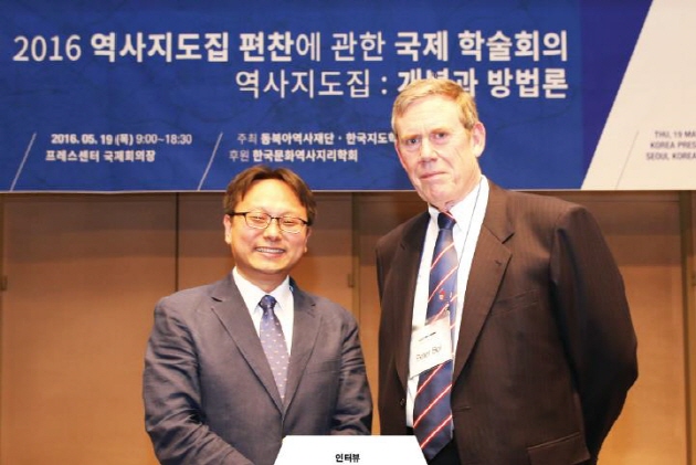
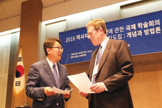
On May 19, 2016, the Northeast Asia History Foundation jointly hosted an international conference with the Korean Cartographic Association at the Korea Press Center under the theme "Historical Atlases: Concepts and Methodologies." This month's interview features a participant of the above conference Professor Peter Bol and his thoughts on a "gold standard" for concepts and methodologies involved with historical atlases.
Peter K. Bol (Professor of East Asian Languages and Civilizations, Harvard University)
Peter K. Bol is the Vice Provost of Advances in Learning and is responsible for HarvardX, the online learning and teaching platform of Harvard University. Apart from his many publications and research papers in English, Chinese, and Japanese, he is the author of This Culture of Ours: Intellectual Transitions in T'ang and Sung China (1994), Neo-Confucianism in History (2010), and is a co-author of Sung Dynasty Uses of the I-ching (1990).
Kim Jong-geun As a historian, what made you initiate the HGIS project which is rather unfamiliar to historians?
Peter Bol The great social-economic historian of China, Robert Hartwell, had been working on a historical GIS for China. I was one of several people interested in it. He died unexpectedly in 1996 and left his estate to the Harvard-Yenching Institute. A few years before he died, he had asked me if I would be willing to take responsibility for it, so once he was gone, I had to do something. There were scholars in China, the US, Taiwan, and Australia who were working on aspects of a GIS for China. We all got together in 2000 to see if we could do a joint project.
Kim Jong-geun Could you please give a brief introduction about the China Historical GIS project?
Peter Bol The China Historical Geographic Information System (CHGIS) project has established an authoritative, freely available database and a GIS that describes the administrative structures of Chinese history. Beginning with the creation of a unified bureaucratic empire in 221 B.C.E., each administrative unit that is known to us in the historical record is entered into the CHGIS database. All the changes of administrative units over time are also stored in the database, including changes caused by internal reorganizations as well as the establishment and demise of competing regimes and dynasties, right up to the end of the dynastic period in 1911 C.E.
The objective of the project is to create an open-ended platform, which can be used as the basis for exploring the administrative divisions through more than 2,000 years of Chinese history, and also to provide a means for the digital representation of their locations in the contexts of space and time. The CHGIS provides users a means to add quantitative and qualitative data on society, politics, economy, and culture for particular periods and areas of interest, allowing users to store, search, compare and analyze their own data in relationship to numerous other types of data within a single unified framework.
Owing to the unique depth and breadth of the Chinese historical record, the CHGIS project must deal with information about the remote past, where exact locations and boundaries cannot be determined and for which no reference maps exist. This is unlike other national GIS projects, the majority of which focus only on the recent past, and are based on geographic units that can actually be defined using existing map sources. In this sense, the CHGIS project has broken new ground in the development of a database for recording ancient historical places, for which uncertainty and vagueness must be taken into account. Indeed, the results of our research indicate that historical GIS must be able to incorporate multiple interpretations of the historical record and deal with the nuance of scholarly disputes by incorporating original quotes and citations in the database itself, rather than representing a single depiction of historical geography as an indisputable fact.
Kim Jong-geun Could you please briefly talk about the past, present, and future of the Center for Geographic Analysis at Harvard University?
Peter Bol he Center for Geographic Analysis (CGA) at Harvard University was established in the fall of 2005 with me as the faculty director. I stepped down in 2014.
The Center is one of the "technology platforms" in the Institute for Quantitative Social Science (IQSS). Building on the foundation already created by the Harvard Geospatial Library and the Map Library, the CGA is focused on expanding the infrastructure for geographic information science and the use of spatial analysis in research and teaching across the greater Harvard community.
The Center has permanent professional staff who can guide complex projects involving geospatial analysis and implement or develop cutting-edge technologies for research and teaching applications. These include continuous-time monitoring of the social and natural environment; the use of GPS, geographic information systems, and geospatial mapping technologies; and the use of mapping systems that combine remote sensing images with vector data.
Kim Jong-geun What was your experience in international collaboration like from working with Chinese scholars in China for the HGIS project?
Peter Bol Here is why we were able to collaborate on CHGIS. There are three crucial elements. First, you must share the vision. Second, someone has to have the expertise. Third, someone has to raise the money. We had an international group of scholars who shared the vision. See the CHGIS website for this. Fudan’s Center had the expertise. Together we were able to raise the funds from the Henry Luce Foundation. But as everyone knows, the work took longer than we had planned.
Kim Jong-geun How would you describe the role of historical research when making a historical atlas?
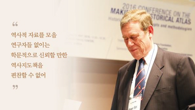
Peter Bol A historical atlas requires researchers who are able to assemble historical data. Without data (to begin with: information on the administrative hierarchy, the location of places, their jurisdictions), there can be no academically reliable historical atlas. It is of course possible to create an atlas of the past that is meant to support the political opinions of someone in the present by making things up. My assumption is that we are committed to academic honesty and integrity and seek to maintain the highest standards of research.
Kim Jong-geun Have you ever run into any difficulties while collaborating with geographers or cartographers for the CHGIS project or other historical atlas projects?
Peter Bol The only project I have been involved with is CHGIS. CHGIS is not a historical atlas. Instead it provides a fundamental GIS that can be used in creating a historical atlas. It does this by providing the locations and temporal extent of administrative seats in the field administration of dynastic states in part of the area of present day China from 221 B.C. to 1911. In addition, we provide some datasets on the river and coastline in the 19th century. We do not really have to work with cartographers since all we do is lines and points. But historical geographers are vital – they are the ones who best know the research on changes in locations, in waterways, in coast lines.
Kim Jong-geun In order to compile and publish a historical atlas that matches a global standard, what sort of collaboration do you think would be necessary among historians, cartographers and geographers?
Peter Bol My keynote address for the conference tries to discuss what I see as the “gold standard” for a historical atlas in our present digital era. But, of course, you have to decide what kinds of information you want to include. Once you know that, then you know what kinds of expertise are necessary for the project.
Kim Jong-geun Which historical atlas would you recommend that is capable of serving as a proper model for the Northeast Asian History Foundation’s historical atlas project?
Peter Bol I think there are many good models. However, the point of my talk was to suggest that you might want to think of “leap frogging” into new technologies. Be a leader, not a follower.
Kim Jong-geun What kind of format do you think would best suit a historical atlas for the 21st century, whether it be a printed book, an online platform, a mix of both, or something completely different?
Peter Bol I think I have made my views clear in the keynote. But, as you heard, not everyone agrees with me! Nor should they.
- Northeast Asia History Network
- Northeast Asia History Library
- DOKDO Research Institute
- DOKDO Museum Seoul
- Education and Training