NORTHEAST ASIAN HISTORY FOUNDATION 09/2022
the Cover
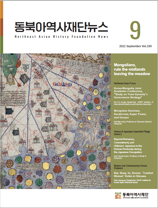
The Catalan Atlas is a world map that compiled Europe’s geographical knowledge in the late 14th century. It was created in 1375 by Elisha ben Abraham Cresques, the master cartographer of Mallorca, Spain. The Catalan Atlas fully reflects Europe's knowledge of world geography, which vastly expanded due to the integration and domination of Eurasia by the Mongol Empire. The cover image depicts the territory of the Yuan Dynasty on the Catalan Atlas. The area called "China" today is labeled as "Catayo (originated from 'Kitai,' a Mongolian word referring to the northern China region during the Mongol Empire)" and the capital of Yuan, the Great Capital (today’s Beijing), as “Chanbalech (originated from 'Khanbaliq,' meaning the City of the Great Khan in Turkish).

The user can freely use the public work without fee, but it is not permitted to use for commercial purpose, or to change or modify the contents of public work.
- Northeast Asia History Network
- Northeast Asia History Library
- DOKDO Research Institute
- DOKDO Museum Seoul
- Education and Training