NORTHEAST ASIAN HISTORY FOUNDATION 08/2018
-
Yi Saang-kyun (Research Fellow, NAHF Dokdo Research Institute)
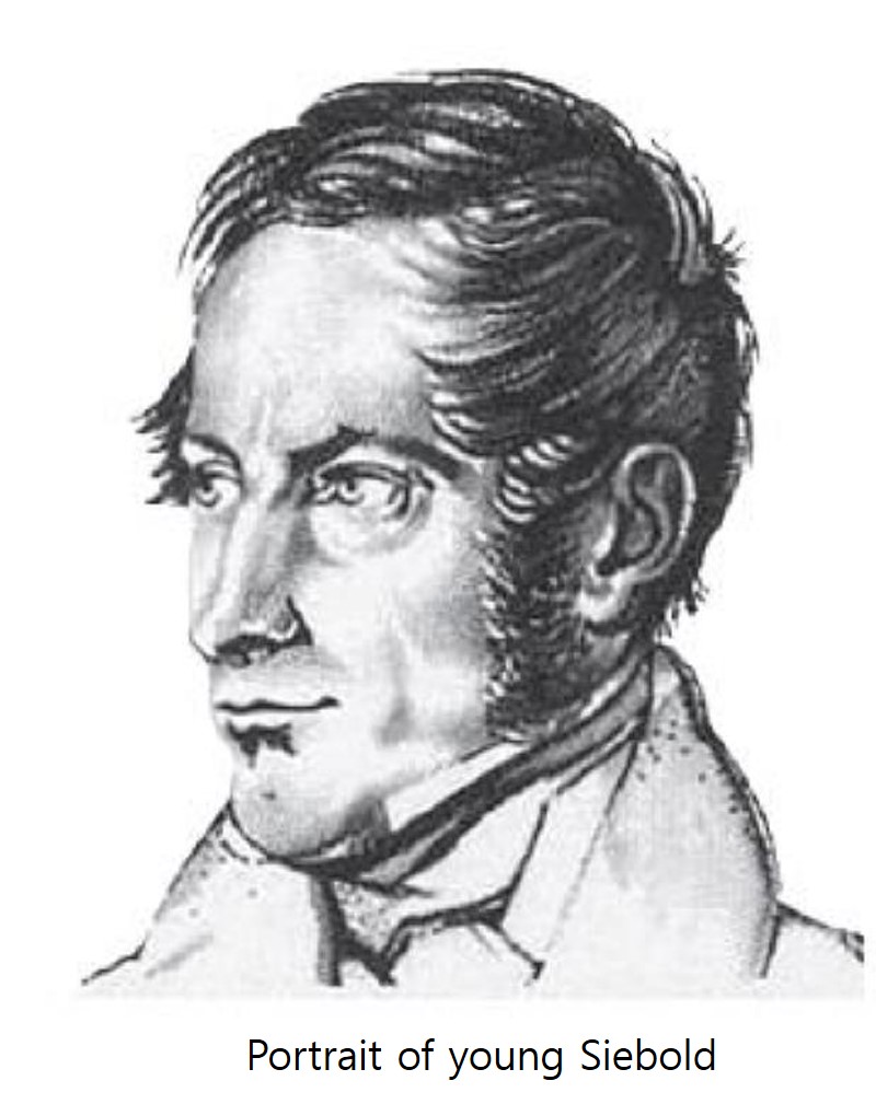 Born in Würzburg, Germany, Philipp Franz Balthasar von Siebold (1796-1866) followed his grandfather and father’s steps by becoming a surgeon. Outside his profession, Siebold was enthusiastic about geography and the world abroad, and dreamed of traveling to distant lands from reading books by the geographer Alexander von Humboldt (1767-1835) who once traveled to South America. He was particularly interested in the Orient, which is what motivated him to go to The Hague in 1822 and seek employment with the Dutch East India Company. He was thereafter posted as an army medical officer to an artillery unit in Batavia (present day Jakarta) in the Dutch East Indies (present day Indonesia). As the Dutch government took over the operation of the Dutch East India Company’s Asian trade division when it went bankrupt, it became necessary for the Dutch government-general to gather information on Japan in order to establish a bridgehead for trade with the country. Japan at the time was practicing a closed-door policy, but allowed foreign merchants to set up trading posts on an artificial island called Dejima in the bay of Nagasaki. On August 12, 1823, Siebold arrived in Nagasaki to work as the resident physician for the Dutch trading post there.
In April 1826, Siebold came by the opportunity to accompany the head of the Dutch trading post on a visit to Edo (present day Tokyo). He was able to meet two Japanese scholars in Edo, one of them being an astronomer named Takahashi Kageyasu (1785-1892). In exchange for several maps of Japan including the Great Japan Coastal Map (大日本沿海輿地全圖), the New Map of the World (新訂萬國全圖), and the Simplified Map of Japan’s Periphery (日本邊界略圖), Siebold presented Takahashi with a copy of “Journey Around the World” authored by the Russian explorer Adam Johann von Krusenstern (1770-1846). However, Siebold’s acquaintance with Japanese scholars later resulted an unfortunate incident. Siebold was caught trying to bring maps of Japan with him as he left for his home country in September 1828, and due to this forbidden act, several Japanese scholars were executed or imprisoned. For giving the maps to Siebold, Takahashi ended up dying in prison.
Siebold was greatly interested in Korea as well. During his time in Nagasaki, there was an institution called Kurayashiki (蔵屋敷) that handled Japan’s diplomatic affairs and trade with Korea. It was there that Siebold was able to meet 36 Korean sailors and merchants from Gangjin in Korea’s South Jeolla Province who had drifted to Nagasaki. This is how Siebold later described the meeting in his book: “I had heard from a Japanese acquaintance about the land of Korea and its language, alphabet, and customs. My meeting today with Koreans from Gangjin quelled much of my curiosity. It was an unexpected achievement. I believe the information I gained from them will serve as a good reference to Europeans ignorant of these aspects.” It is quite amusing to think that what Koreans who drifted to Japan from Gangjin, the very place where Hendrick Hamel (1630-1692) escaped from, told the German surgeon about their country ended up in a book that would introduce Korea to the West, nearly 180 years after the publication of “The Journal of Hendrick Hamel.”
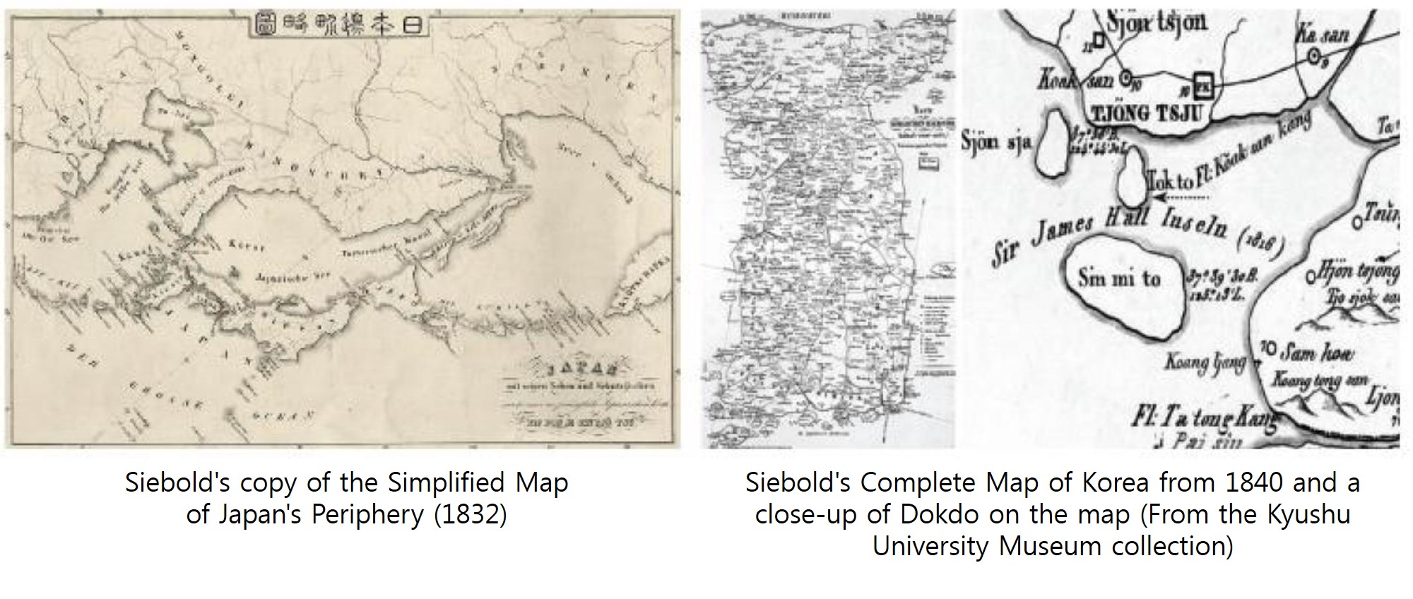
In 1832, Siebold made a copy of the Simplified Map of Japan’s Periphery (1809) made by Takahashi Kageyasu and included the copy in the first volume of his documentation about Japan published under the title "Nippon." In the copied map, Korea is noted as "Korai" or "Tsjo-sjon." During the process of translating Takahashi's map into German, Siebold added the notation "Channel of Korea" (Kanaal van Korai) to the waters between Korea and Japan. And based on Japan's understanding of the islands Ulleungdo and Dokdo (Matsushima and Takeshima), Siebold demarcated the Korean peninsula's maritime boundary outside the two as islands. Siebold also created a complete map of Korea with the information he gathered, which included names of ancient Korean kingdoms such as Mahan (Ma han) and Byeonhan (Pjon han). Another interesting detail about the map would be the notation "Ori Kang" referring to Amnok River (鴨綠江) at the northern end of the Korean peninsula. "Ori" is a phonetic expression of the Korean word for duck, which is what the Chinese character Am (鴨) stands for, while "Kang" is the phonetic expression of the Chinese character that means river (江).
Siebold's map shows that he must have done some in-depth research into the language and history of Korea. A detail significant to Korea would be the notation "Tok to" prescribed to the island along the southwestern coast of Pyeongan Province. The island is labeled in Chinese characters as "Seokdo" in old maps from late Joseon, a name still used for the island in contemporary North Korean atlases. The fact that the Korean geographical name Seokdo was translated into Tokto (Dokdo) by a Westerner in the nineteenth century is significant in terms of securing evidence that supports Korea's dominium of the island Dokdo.
It is said that the geographical information Siebold collected on East Asia was passed on to the American admiral Matthew Calbraith Perry (1794-1858) when he was heading for Japan in 1853, which is an indication of how greatly Siebold's interest in and research of the Orient contributed to East-West exchange and cartography.
- Northeast Asia History Network
- Northeast Asia History Library
- DOKDO Research Institute
- DOKDO Museum Seoul
- Education and Training