동북아역사재단 2022년 04월호 뉴스레터
- Kim Jong-geun Researcher, Dokdo Research Institute
Bernadou Dispatched to Korea to Collect Folklore Materials
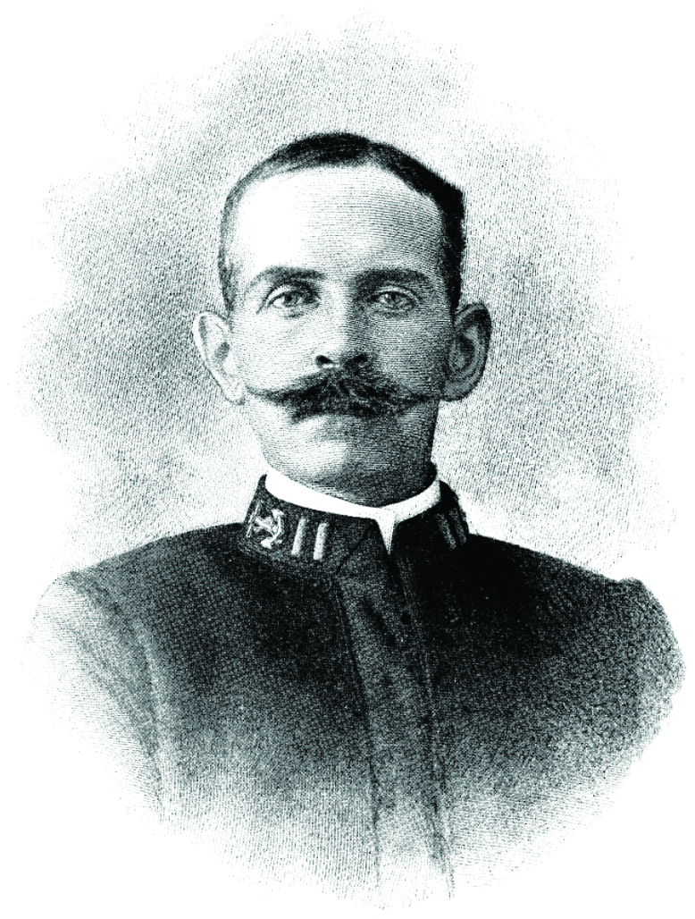
This year marks the 140th anniversary of establishing diplomatic ties between the USA and Korea. Academic circles had examined the relationship between the USA and Korea during the enlightenment period, focusing on the activities of missionaries and medical personnel. Recently, there has been increasing interest in the diplomats affiliated with the US government dispatched to Korea. The Korea travel diary by Navy Officer George Clayton Foulk (1856-1893), 『Foulk, Who Came on a Steamer, Records Korea with Daedongyeojido (Detailed Map of Korea)』 was also published in 2021. At a symposium co-hosted by the foundation and Yeungnam University's Dokdo Research Center on February 28, I gave a presentation on John Baptiste Bernadou (1858-1908), a naval officer who visited Korea immediately after the establishment of diplomatic ties between the USA and Korea, the map he collected, “Haedong Jeondo (Map of Korea),” and Dokdo Island in the map. I would like to introduce the research results I presented at the symposium in this article.
The US government wanted to establish a world-class museum by collecting folklore materials from worldwide. It commissioned the Smithsonian Institute to operate the United States National Museum (USNM) program. Bernadou, a naval officer, was assigned to this program in 1882, trained in museum specimen collection, and sent to Korea in March of 1884. Between 1884 and 1885, Bernadou collected more than 160 pieces of various folklore materials from Korea, including furniture, paintings, agricultural implements, ceramics, handicrafts, musical instruments, clothes, ornaments, and textiles, prints, and books. These items have been managed at the Smithsonian Museum in the USA under the name of The Bernadou Korean Collection (1884-1885). There are eleven maps among these exhibits, including “Haedong Jeondo,” which will be introduced today.
Dokdo Island in Haedong Jeondo, Written in Korean and Chinese Characters
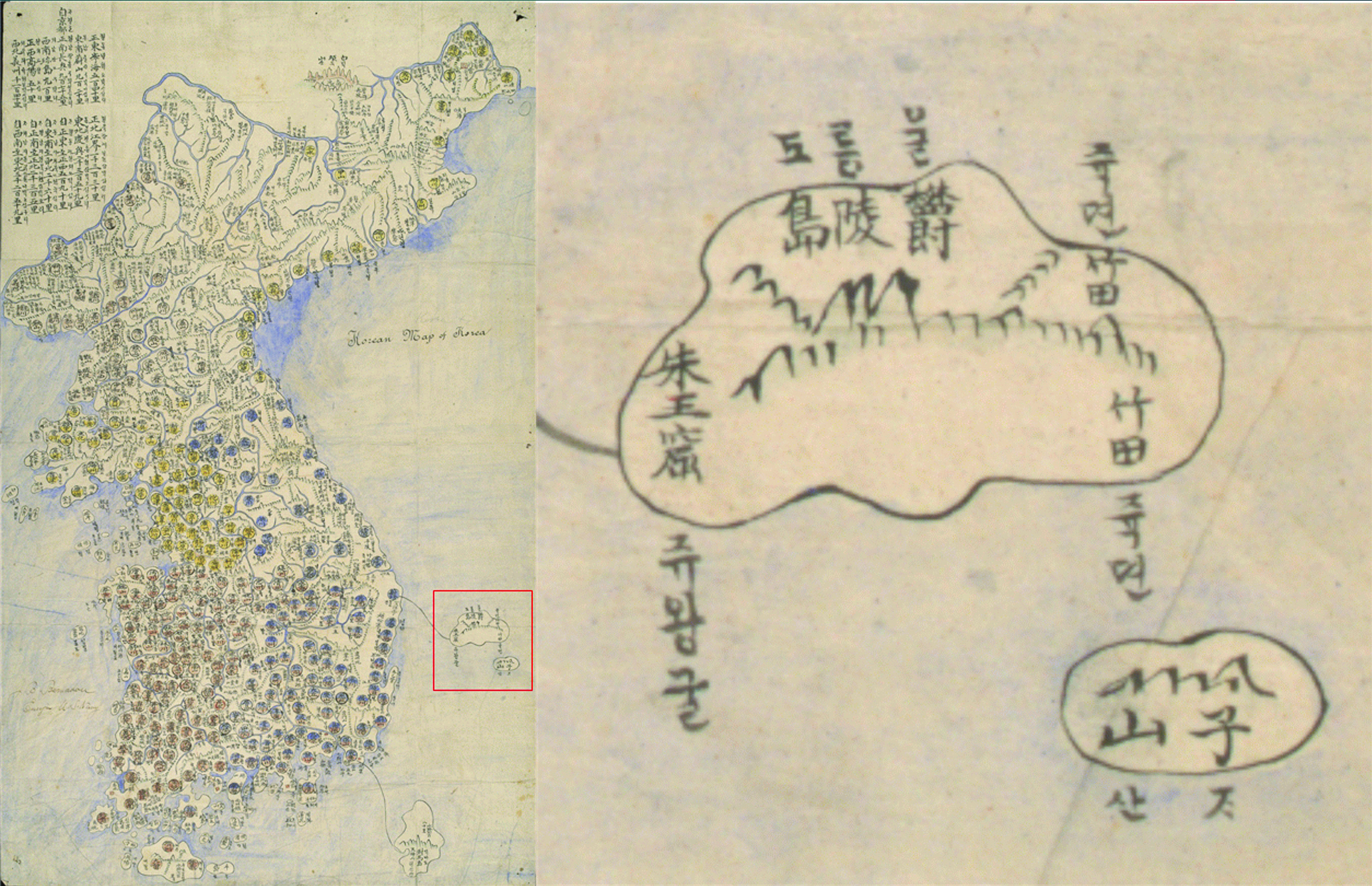
「Haedong Jeondo」, collected by Bernadou, is a replica of a map made in the mid-19th century, owned by Bishop Marie Jean Gustave Blanc (1844-1890), a French missionary who was staying in Seoul at the time. It is one of the maps following the tradition of "Dongguk Jido (Map of Korea)" produced by Jeong Sang-gi in the mid-18th century, the first map that depicted the Korean Peninsula close to its actual shape. The difference between this map and existing maps is that the place names are written in both Korean and Chinese characters. According to Bernadou's record, Westerners needed to know the Chinese names and the exact Korean names of the places to clearly understand the names of different places in Korea. He added Hangeul (Korean alphabet) when making a copy of the map. This is the first map in which Korean and Chinese characters are written side by side among the ancient maps of Korea that follow the tradition of "Dongguk Jido" by Jeong Sang-gi.
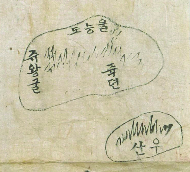
About Dokdo, it is worthy of taking note of the fact that Usando Island (于山島), which is Dokdo Island, is marked in Korean and Chinese characters as ‘Jasando (ᄌᆞ산·子山),’ and drawn in about 1/3 of the actual size in the southeast of Ulleungdo Island. First of all, regarding the notation of Dokdo Island, there are cases where it was marked with similar Chinese characters, such as Cheonsando (千山島), Jasando (子山島), Gansando (干山島), and Bangsando (方山島) beside Usando (于山島) on various old maps. These cases are generally explained as the misspelling of "Usando," and the case of "Jasando" in Haedong Jeondo seems to be another case of typo. However, the fact that An Yong-bok used the name "Jasando" when he went over to Japan and revealed that Dokdo Island is Korean territory implies that "Jasando" could have been used as an alias for "Usando," which requires further research.
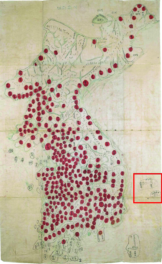
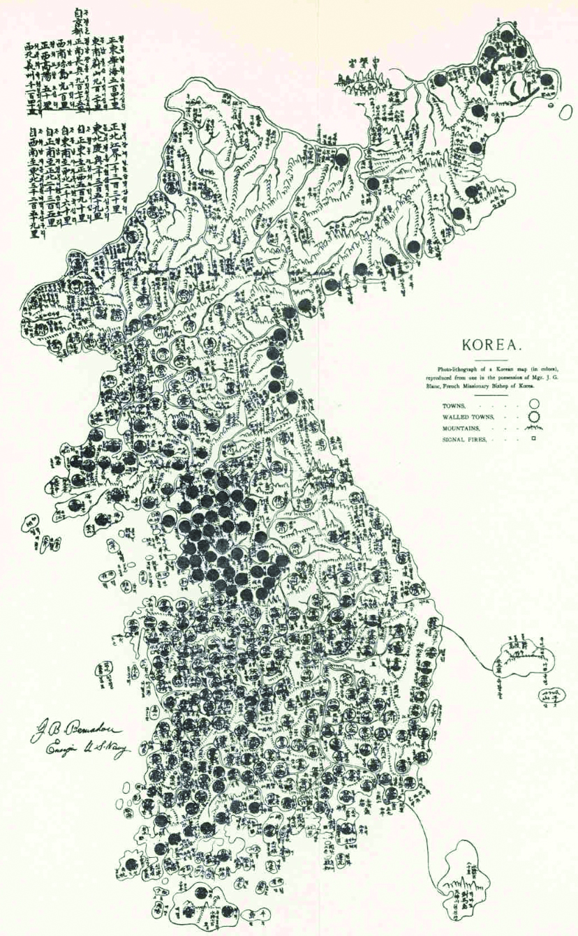
In addition, the location of Dokdo Island drawn in 「Haedong Jeondo」 and also previously known maps produced in the style of 「Dongguk Jido」 by Jeong Sang-gi are slightly different. In other words, Usando Island was drawn to the east of Ulleungdo Island in Jeong Sang-ki's 「Dongguk Jido」, but it was clearly marked to the southeast of Ulleungdo Island in 「Haedong Jeondo」 collected by Bernadou, and the size is also larger. Among the maps where Dokdo Island is drawn in a similar manner, there is a map called “Dyosyeon Dyeondo (Map of Korea),” which is in the collection of the British Library. This map was also produced during the enlightenment period. So far, the reason Dokdo is depicted differently in these two maps from the 「Dongguk Jido」 by Jeong Sang-gi is unknown. Still, it shows that the awareness of Dokdo Island became more apparent during the second half of the 19th century. Also, a waterway was marked between Uljin and Ulleungdo Island in Haedong Jeondo to show the Korean government's exploration of Ulleungdo Island
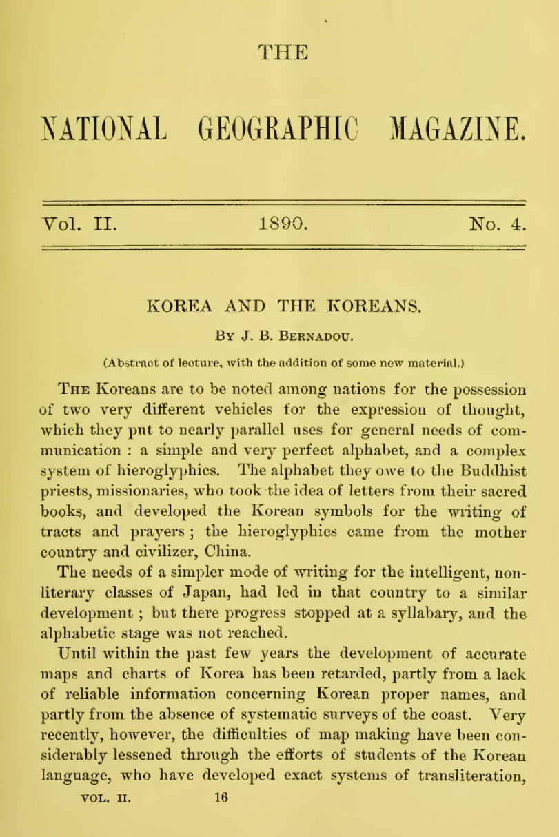
「Haedong Jeondo」 Featured in National Geographic
After collecting folklore and geographic data in Korea, Bernadou returned to the USA in 1886. After that, he was assigned to the U.S. Naval Intelligence Division. Also notable is that in 1890, he gave a lecture on Korea at the National Geographic Association, which was later inserted in the August 1890 issue of National Geographic magazine under the title, 'Korea and the Koreans.' The article introduces the geographical names and maps of Korea and the humanities and natural geography in general. It included three maps, including 「Haedong Jeondo」, to describe the geography of Korea.
In particular, 「Haedong Jeondo」 clearly shows the territory of Korea, composed of the Korean Peninsula and its islands. Through the writings of Bernadou and maps, the US government, academic circles, and the public were able to understand what the country Korea looked like and what geographical characteristics it had. Furthermore, 「Haedong Jeondo」 helped Americans recognize that Dokdo Island was clearly included in the territory of Korea.
Necessity to Collect Overseas Materials for the Study of Dokdo Reconfirmed
In this article, I briefly introduced the research results regarding 「Haedong Jeondo」, which was newly discovered due to the research project on old maps in overseas collections as part of the research project planned by the foundation in 2021. This study illuminated that 「Haedong Jeondo」 became a collection of the Smithsonian Museum in the USA through Bernadou and was introduced in National Geographic magazine, helping Americans recognize Dokdo Island as Korea's territory. I have been collecting old maps from overseas since 2019 and discovered Phelan's 「Joseon Jeondo」 and 「Joseon Jeondo」 in Latin version at the National Archives and Records Administration (NARA) in the USA and the National Library of France. As such, new materials related to Dokdo Island are highly likely to be excavated abroad. I intend to expedite the discovery of historical materials overseas that can strengthen our sovereignty over Dokdo Island in the future.
동북아역사재단이 창작한 '미국 스미소니언 박물관 소장 「해동전도」와 독도' 저작물은 "공공누리" 출처표시-상업적이용금지-변경금지 조건에 따라 이용 할 수 있습니다.