동북아역사재단 2022년 04월호 뉴스레터
- Jeong Yeong-mi, Director, Dokdo Research Institute
Japanese Ministry of Foreign Affairs' "Explanatory Materials" on Territorial Issues
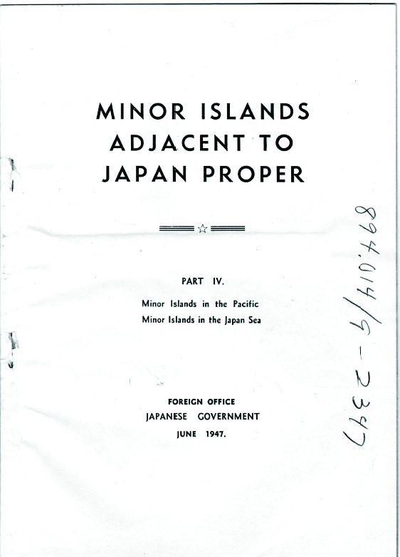
From 1946 to 1949, the Japanese Ministry of Foreign Affairs produced seven volumes of “Explanatory Materials,” a collection of materials that explained the islands Japan sought recognition from the Allied Powers as Japanese territory. Among them, five books (①-④, ⑦) kept in the National Archives and Records Administration of the USA were investigated, collected, and analyzed by Professor Jeong Byung-jun of the Department of History at Ewha Womans University. In 2021, our foundation received these materials as donations and published them as a collection of materials and analysis articles. * Among these, I would like to introduce “Part 4 Islands in the Pacific and East Sea [Sea of Japan]” (“Explanatory Material ④”) related to Dokdo Island.
* Section by Jeong Byeong-jun, 2021, 『Source Book on the San Francisco Peace Treaty – Japanese Ministry of Foreign Affairs' Source Book on Territorial Issues after the Second World War and Policy Analysis』, Northeast Asian History Foundation
Purpose of Producing and Distributing ‘Explanatory Materials’
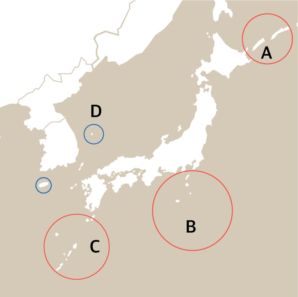
On September 17, 1945, MacArthur's Supreme Commander for the Allied Powers (GHQ/SCAP) was installed in the Dai-Ich Life building in Tokyo. After that, MacArthur carried out the overall occupation policy to realize the Potsdam Declaration. He also limited “Japan’s sovereignty to Honshu, Hokkaido, Kyushu, and Shikoku, as well as the small islands we, the Allied Powers, determine.” according to Article 8 of the Potsdam Declaration. Initially, the scope of “the island we determine” was about 1,000 small islands, including Tsushima. Still, when SCAPIN 677 was issued, it was reduced to the islands distributed, as shown in the picture. For this, seeking the Allied Powers' recognition of these islands as Japanese territory became the essence of Japan's territorial issues. This became the purpose of producing and distributing ‘explanatory materials.’
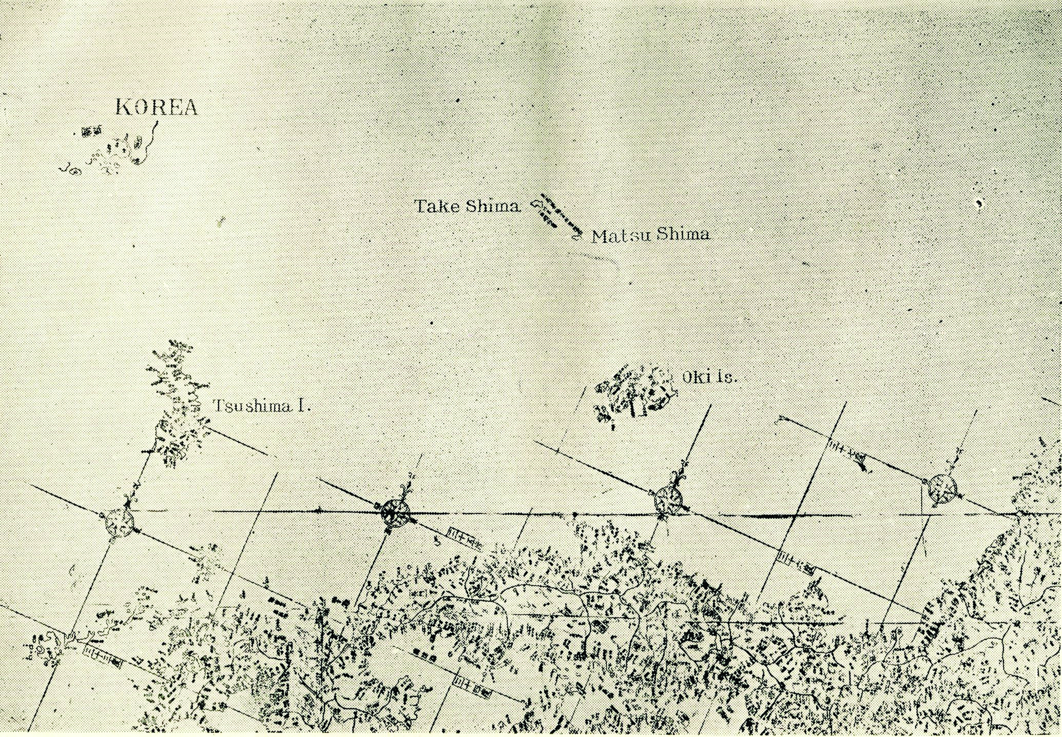
④ 「Japan's Annexed Islands Part 4 Islands in the Pacific and East Sea [Sea of Japan] and Ulleungdo and Dokdo Islands
Part 4 of the 'Explanatory Materials' deals with the Taito Islands [Islands in Figure C] and Minamitorishima and Okinotorishima [Islands in Figure B] in the Pacific region, and Ulleungdo and Dokdo Islands [Figure D] in the East Sea region. However, among the islands in the East Sea, the islands regarded as the "islands we determine" were the three islands: Jejudo, Ulleungdo, and Dokdo Islands. Of these islands, Japan wanted two islands - Ulleungdo and Dokdo Islands - recognized as Japanese territory by the Allied Powers, and such attempts have a long history.
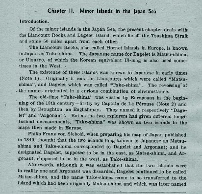
Japanese and Ulleungdo and Dokdo Islands
Japanese people came to Ulleungdo Island during the Edo period and took wood and abalone without permission. On the way back to Japan, they also stopped by Dokdo Island. This ended with the Edo Shogunate banning Japanese people from traveling to Ulleungdo Island in response to a protest from the Korean government. However, in the Meiji period, Japanese people came to Ulleungdo Island again to take resources. This also ended when the Japanese Ministry of Foreign Affairs confirmed that the island the Japanese had entered was Ulleungdo Island of Joseon.
Significance of ‘Explanatory Material ④’ concerning Dokdo Island
During the Edo period, Japanese people were drawn to Ulleungdo Island, which was habitable and rich in resources. However, during the Meiji period, as the commercial viability of Dokdo Island's sea lion fishing became known, attention was also drawn to Dokdo Island. This led to the annexation of Dokdo Island in 1905. ‘Explanatory Material ④’ mentions Ulleungdo Island along with Dokdo Island that they had already incorporated, confirming once again Japan’s deep-rooted interest and greed for Ulleungdo Island and the illegality of the annexation of Dokdo Island.

동북아역사재단이 창작한 '제2차 세계대전 이후 일본 외무성의 영토문제 자료집과 울릉도·독도' 저작물은 "공공누리" 출처표시-상업적이용금지-변경금지 조건에 따라 이용 할 수 있습니다.