동북아역사재단 2017년 07월호 뉴스레터
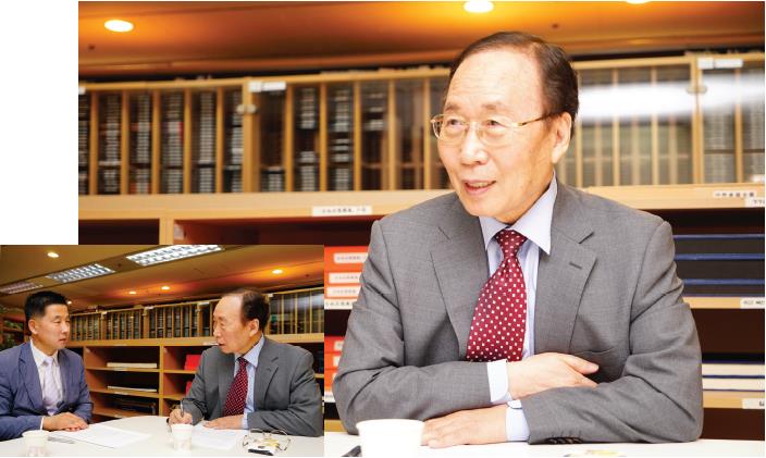
- Lee Ki-suk (Professor Emeritus, Seoul National University)
Korea and Japan have maintained different opinions about what to call the sea lying between the Korean peninsula and the Japanese archipelago. As the two countries seem to still be far away from agreeing upon a single name to be used internationally, this month's interview attempts to gain insight in arriving at a resolution by turning to Professor Emeritus Lee Ki-suk of Seoul National University who has long been studying the matter of naming Dokdo and the East Sea.
Interviewer: Kwak Jino (Research Fellow, NAHF Institute of Dokdo Research)
Lee Ki-suk (Professor Emeritus, Seoul National University)
Professor Emeritus Lee Ki-suk studied geography at Seoul National University before going on to acquire his master's and doctoral degree in the same field from the University of Minnesota in the United States. Apart from teaching geography education as professor at Seoul National University, he has served as a visiting professor at the University of Minnesota as well as president of the Korean Geographical Society. He is currently professor emeritus at Seoul National University and a member of the Republic of Korea's National Academy of Sciences. He also serves as an advisor to the Society for the East Sea. He is co-author of "Dumangang hagu Nokdundo yeongu" [A Study of Nokdundo at the Duman River Estuary], "East Sea in Old Western Maps," and "Jidoro bon Seoul" [Seoul in Maps].
Q1. We would like to start by asking how you been doing, health-wise and research-wise. Could you tell us about what you’ve been interested in or have been working on lately?
Lee Ki-suk First of all, thank you for inviting me to this interview. As you can see, my health is fine. I’ve lately been compiling material on a research topic I used to invest quite some time in during my days as a professor, which is the development process of ancient Korean cities. Many of those cities are actually located in today’s North Korea or China, so prior to 1990, it was impossible to conduct field investigations. As China began to open up, I visited numerous sites located in Ji’an, China and other locations related to the ancient Korean kingdom of Balhae to do the ground work of collecting data and material. The way a historian sees a city is different from how a geographer would, so that’s also a gap I’ve been trying fill. Other than that, I've been offering advice on the matter of naming the island Dokdo and the East Sea from time to time since I’m still serving as an advisor to the Ministry of Foreign Affairs on its policies toward Dokdo.
Q2. You originally studied geography, so what made to develop an interest in the naming issue surrounding Dokdo and the East Sea?
Lee Ki-suk Dokdo and the East Sea are both part of the Republic of Korea’s territory, so any South Korean geographer is bound to and should take an interest in matters involving them. It would be impossible, particularly for geographers, to remain as bystanders while their country’s territorial sovereignty over Dokdo or the East Sea gets violated. In fact, it would be the same for any scholar whose research could be linked to the matter, such as those who study history or international politics. Protecting the Republic of Korea’s sovereignty over Dokdo and recovering our identity by properly naming the East Sea are matters that concern us all.
In my case, I became deeply involved in the matter of geographical naming not long after the Republic of Korea joined as a member of the United Nations in 1991. In the following year, the 1992 conference for the United Nations Group of Experts on Geographical Names was held and South Korea officially requested for the first time for the East Sea’s standard name to be corrected. However, internationally standardizing a new name does not happen by merely making a request, but requires a lot of negotiating with other countries involved and satisfying requirements in relevant resolutions. So, when the next conference took place in New York two years later in 1994, the government repeatedly invited me to attend the conference as a civilian representative of South Korea. That's how I ended up serving as a civilian expert until 2012. I’ve also been attending the assembly of the International Hydrographic Organization, which standardizes the naming of bodies of water, to lend my support in resolving related issues.
Q3. Naming the East Sea and the territorial sovereignty of Dokdo have become increasingly controversial issues between South Korea and Japan. What do you think aggravated matters the most?
Lee Ki-suk Rather than singling out one particular reason, I would say that South Korea’s past as a colony of Japan is at the bottom of it all. The East Sea was incorrectly labeled as the Sea of Japan in 1929 when the International Hydrographic Organization published the Limits of Oceans and Seas containing standardized sea names, which is why many maps are still using the incorrect name today. There’s a similar pattern surrounding the issue with Dokdo. Japan secretly incorporated the island into its territory in February 1905 during the process of colonizing Korea, renamed it as “Takeshima,” and has continued to claim that the island belongs to Japan. Prior to the 1900s, the names of islands and seas were not standardized because the information map makers each had varied. Unfortunately, sea names became standardized through an International Hydrographic Organization assembly held while Korea was still a colony of Japan, which is how the name East Sea came to be replaced with the name Sea of Japan. And Dokdo also lost its original name in 1905 when Japan illegally incorporated the island. Issues regarding sovereignty or naming all occurred under the rule of Imperial Japan, so Japan's persistent provocations can only be seen as a reaction to the geographic as well as economic importance the East Sea and Dokdo have rapidly been gaining over time.
Q4. From your experience as president of the Society for the East Sea, to which you’re still serving as an advisor, you may have noticed that Koreans lack in their understanding about the issue of naming the East Sea compared to the amount of interest they take in the issue of Dokdo’s sovereignty. So, could you please remind us why correctly naming the East Sea is important and tell us where we’re now at on the matter? We would also like to hear about any achievements the Society for the East Sea has made since its foundation.
Lee Ki-suk I don't think there's a particular problem among South Koreans regarding their understanding of Dokdo's sovereignty or naming the East Sea. Everyone knows that Dokdo is South Korean territory and that the name of the waters to our east is the East Sea. The problem is that the understanding people have outside of South Korea can be somewhat behind the times, probably because the size of Dokdo is so tiny that it tends to be omitted from many small-scale maps published around the world. The government and experts in South Korea recognized the error in the East Sea's denotation around 1950, but it took considerable time before the matter of internationally correcting the error could be raised for discussion.
Koreans have used the name East Sea without changing it for more than two thousand years. We just had no idea what the East Sea was being called overseas and we didn't necessarily promote the name by widely distributing maps made in Korea. Moreover, it was difficult in the 1960s and 1970s for such an issue to gain much attention.
I would say the Society for the East Sea mainly achieved two things since its foundation. One is that it succeeded in internationally raising awareness toward the history behind the East Sea and the fact that its denotation has been incorrect. Most scholars and the press now seem to possess some degree of awareness regarding the East Sea. Yet, I feel that there's still a bit more experts can do to further raise awareness. The Society's other achievement is the contribution it has made to systematizing academic research on geographical names in South Korea. Since 1997, the Society has annually been hosting the "International Seminar on Sea Names," thereby providing an occasion to invite renowned scholars, have them present their research, and gather their opinions on the issue of naming the East Sea. Thanks to such efforts, the seminar has turned into one of the most authoritative of its kind for experts all over the world.
Q5. So, what are the most notable changes you've witnessed as a result of such efforts to correct the name of the East Sea?
Lee Ki-suk When the Society was established, it was hard to find the exclusive use of the name East Sea in any of the well-known world atlases. Around the time the Society began to raise awareness toward the issue through various activities such as the international seminar, a mere two percent of the top one hundred world atlases were either exclusively or simultaneously using the name East Sea as of 2000. However, a survey done in 2016 confirmed that out of a list of the best atlases selected by world-renown geographers, nearly half of the one hundred atlases on the list were either exclusively or simultaneously using the name East Sea. It's a remarkable change that no individual or government is likely to achieve on their own. I would consider it as proof that many have come to agree with the need to correct the East Sea's denotation.
Q6. Regarding Japan's provocations over the territorial sovereignty of Dokdo, some in South Korea say, "it's best not to react," while others say, "it's necessary to show a firm response." What is your take and how do you think we should respond to Japan's provocations?
Lee Ki-suk I find that some form of response needs to be shown against unjust claims made by neighboring countries over our territory. Showing no response would be allowing Japan to change Dokdo's name to "Takeshima" and to teach distorted historical facts to its people. What's important is that despite the fact that the Japanese have not been able to travel to the island since 1945, they are still being taught that "Dokdo is Japanese territory." What I find problematic is that such a description is not being questioned by people in Japan. The Japanese government's current actions may be marked as a stain in history later on, but for the time being, it's likely to stick to its far-fetched claims. What we ought to do is keep up with our domestic education on issues surrounding the island and steadily remind the international community that the island is part of South Korea. It would help to continue publishing and distributing booklets that offer accessible introductions on the history, nature, and geography of Dokdo.
Q7. Your research into Nokdundo (鹿屯島), "the lost land at the mouth of the Duman River," attracted attention in the early 2000s. What drew your interest toward the island and what does it mean to us Koreans?
Lee Ki-suk I began studying Nokdundo while conducting a field investigation on the east coast of China to figure out whether an economic cooperation zone could be formed between China and South Korea's west coast. The idea particularly gained interest from scholars in the two Koreas as well as Mongolia, China, and Russia when the United Nations proposed the "Tumen River Area Development Programme" around 1990. At the mouth of the Duman (Tumen) River, Nokdundo used to be a piece of land the people of Joseon cultivated for farming. However, the island became mistakenly incorporated into the Soviet Union's territory after the First Convention of Peking was concluded in 1860. It thereafter became Russian territory without the Korean government managing to get so much as a chance to protest and regain the land.
Geographically speaking, there are barely any records left on Nokdundo, so no one knows exactly where the island used to be or how large it was. Its existence only remains in historical records and my guess is that its size was about one-eighth the size of Seoul. The island was made of sand sediment and became abandoned since the 1930s, so there's not much left if you look at it now. While under the rule of Imperial Japan, many Koreans temporarily fled to Nokdundo and it used to serve as one of the bases for carrying out independence movements. There are still traces of rice fields and farm houses in the area, which I was able to personally investigate six times over a span of seven years with assistance from the Russian Academy of Sciences.
Q8. The role of scholars who study territorial issues seems important since Korea is geographically surrounded by powerful countries. Is there anything you wish to pass along to the younger generation of experts studying geography?
Lee Ki-suk Territory is the foundation of our lives, where our homes are. We must make efforts to protect it, or else we may end up being forced to live as nomads. That is also why collaboration between geographers, historians, and political scientists will be necessary from now on. It's actually only been ten years since a territory-related government organization was established in South Korea. Organizations such as that need to be reinforced and publications about territory should be released annually. We say we know enough about our own territory, but many are unable to give the right answer when they're asked about the location of Ieodo. Like Japan annually publicizes its territory through its Diplomatic Bluebook and Defense White Paper, we too should try to widely publicize the territory of Korea by regularly releasing official publications. Various difficulties have kept us from making greater progress in territorial research, but I trust that the younger generation of scholars will be able to do a better job.
Q9. You're familiar with what our Foundation's been doing since you've served as a member of the advisory committee and the board of directors from the beginning. In your opinion, what did the Foundation contribute or fail to contribute so far and which direction do you think it should head toward in the future?
Lee Ki-suk My ties to the Foundation began since I took part in the committee to launch a task force for truthful history that later developed into the Northeast Asian History Foundation. I think it's too early to make any judgements about the Foundation's activities. What I can say is that the Foundation has devoted a lot of time on conducting research and making suggestions regarding the issues lying before it, so I hope it will now be able to take advantage of its experience and get involved in more in-depth, systematic activities. One thing I feel that's urgent is for it to secure an independent space of its own that better suits the kind of in-depth research it needs to commit itself to. There's just not enough space at the office building it's currently housed in, so issues like that need to be taken care of in order to determine whether the Foundation really has been fulfilling its purpose. Anyway, it's a relief to have witnessed the Foundation evolve over the past ten years since its establishment. The Foundation has contributed to raising awareness toward historical and territorial issues our country is going through with neighboring countries and toward introducing new understandings about our past. Releasing a publication summarizing its research findings and opening a library for material on northeast Asian history have both internally and externally helped support the Foundation's research efforts. I hope the Foundation will be able to carefully analyze the achievements it's made so far to determine the direction it should head toward in the future.