동북아역사재단 2022년 09월호 뉴스레터
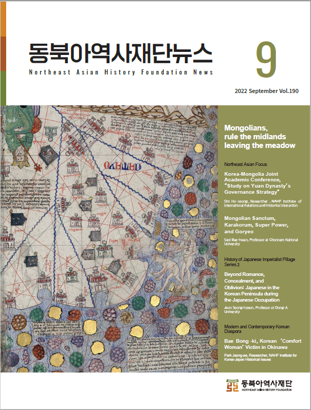
The Catalan Atlas is a world map that compiled Europe’s geographical knowledge in the late 14th century. It was created in 1375 by Elisha ben Abraham Cresques, the master cartographer of Mallorca, Spain. The Catalan Atlas fully reflects Europe's knowledge of world geography, which vastly expanded due to the integration and domination of Eurasia by the Mongol Empire. The cover image depicts the territory of the Yuan Dynasty on the Catalan Atlas. The area called "China" today is labeled as "Catayo (originated from 'Kitai,' a Mongolian word referring to the northern China region during the Mongol Empire)" and the capital of Yuan, the Great Capital (today’s Beijing), as “Chanbalech (originated from 'Khanbaliq,' meaning the City of the Great Khan in Turkish).

동북아역사재단이 창작한 '카탈루냐 지도 : 원나라 부분' 저작물은 "공공누리" 출처표시-상업적이용금지-변경금지 조건에 따라 이용 할 수 있습니다.