동북아역사재단 2019년 03월호 뉴스레터
- Yi, Saangkyun(research fellow at the Dokdo Research Institute, Northeast Asian History Foundation)
 The fact that
Ulleungdo and Dokdo were the intrinsic territories of the Korean people can be
confirmed through the large amounts of data excavated in both Korea and Japan.
However, as the Japanese government insists on Japanese sovereignty over Dokdo,
the Japanese-Korean relations are deteriorating. Moreover, the conflict worsens
as the Japanese government tries to solve the Dokdo territorial issue through a
third party, such as the International Court of Justice. If this is the case,
is Japan's claim of Dokdo as Japanese territory reasonable? To answer this
question, it is necessary to illuminate the situation starting in the 19th
century.
The fact that
Ulleungdo and Dokdo were the intrinsic territories of the Korean people can be
confirmed through the large amounts of data excavated in both Korea and Japan.
However, as the Japanese government insists on Japanese sovereignty over Dokdo,
the Japanese-Korean relations are deteriorating. Moreover, the conflict worsens
as the Japanese government tries to solve the Dokdo territorial issue through a
third party, such as the International Court of Justice. If this is the case,
is Japan's claim of Dokdo as Japanese territory reasonable? To answer this
question, it is necessary to illuminate the situation starting in the 19th
century.
Inspecting Dokdo from a Foreigner's Perspective in Order to Grasp the True Nature of Dokdo
The 19th century was a time when the encounters and exchanges between the East and the West were maximized, and scientific exploration entailed cartography. Since then, Japan began producing world maps in earnest, actively embracing the Western mapping tradition and providing geographic information that was produced in Japan to the Western world. The 19th century is a history that is closest to our contemporary society in which we now live, and it is also a pathway linking traditional society to modern society, the Western world and the Eastern world. Therefore, if we can properly grasp the complex situation that existed in East Asia during the 19th century, we will be able to clearly understand the true nature and limitations of Japan's claim. Information on the islands in the East Sea near the Korean Peninsula was reflected in the "Complete Map of Qing", that was made in the Qing Dynasty in 1717 and delivered to the French royal court 20 years later in 1737. The information was translated into various languages and circulated around Europe, eventually spreading throughout the entire world. In the late 18th century, maritime countries such as Britain and France started exploring the Far East, based on the geographical information obtained through China. Geographic information concerning the Far East became increasingly accurate during the 19th century, as newly discovered geographic information was added and inaccurate geographic information was erased from the map. At that time, geographic information about East Asia was circulated mainly around the Western powers such as Britain, France and Russia, and testimonies from explorers were reflected in the map’s production.
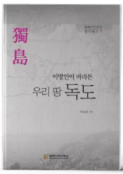
A Book that Depicts the True Picture of Dokdo Sovereignty
The first part of this book, entitled "Ulleungdo and Dokdo Seen from the Western World," deals with Britain, France and Russia's exploration of the East Sea, and Westerners' discovery of Dokdo. Chapter 1 deals with the background of the entry into the East Sea of British merchant ship, Argonaut, at the end of the 18th century. Although Argonaut Island is not directly linked to Dokdo, it is an important theme that cannot be overlooked when conducting research about Dokdo, as the island provides a fundamental cause for Japan to incite confusion about the names of Ulleungdo and Dokdo in the 19th century. Chapter 2 is about the French Warship Capricious' exploration and mapping of the East Sea. This chapter analyzes the background and mission of the Capricious, its motivation for exploring the East Sea, the process of exploration, and a series of processes ranging from the uncertainty of Argonaut Island's existence to the mapping of the island. Chapter 3 deals with the Russian warship Pallada's exploration and mapping of the East Sea close to the Korean Peninsula. It is worth noting that Russia's map of the East Sea depicted Dokdo in the East Sea of Korea, on the eastern coast of the Korean Peninsula. Knowing that the Japanese Ministry of the Navy directly copied Russia's map, it can be confirmed that the Japanese government recognized Dokdo as a Korean territory located in Korea's East Sea, at that time.
The second part, titled "Ulleungdo and Dokdo Seen from Japan," objectively analyzes the situation of Ulleungdo and Dokdo from the perspective of foreigners in the 19th century, and attempts to concretely demonstrate the contradiction in Japan's theory of indigenous land. Chapter 4 analyzes Nagakubo Sekisu's "1779 Chart of Japan and the East Sea “Revised Complete Map of Japanese Lands and Roads," which had triggered a heated debate between Korea and Japan, from the perspective of sovereignty. At present, Japan’s Ministry of Foreign Affairs has this map posted on its website and highlights the fact that Japan was clearly aware of Dokdo. Although it is true that Ulleungdo and Dokdo are clearly represented on this map, one can conclude that these islands are not fundamentally related to Japan as there is an explanatory note explaining that the islands are Joseon's territory, and because there is no sea distance line connecting Japan's mainland or Oki Island to either Ulleungdo or Dokdo. Chapter 5 analyzes records related to Dokdo in the "Journal of Geography," a representative Japanese academic journal from the early 20th century. This journal was used as means to promote the Meiji government's external expansion policy. One issue of the journal published in the late 1890’s claimed that a new island called "Yanko" had been discovered, and that it had not been identified on maps from both Japan and the West. However, as mentioned in documents such as "Dajokan Order ," although the Japanese authorities were well aware of the island's existence at the time, information about the island regressed by the late 19th century. Chapter 6 deals with the true nature and limitations of Japan's claim of sovereignty over Dokdo. Japan's claim was largely unfounded in two respects, namely, the fact that around 1870, the Japanese government sent three Foreign Ministry officials to Korea in order to determine to which country Dokdo belongs. According to the report filed by the investigation's team upon returning to Japan “Secret Report on Chosun”, Dokdo was found to not be Japanese territory. Additionally, "Dajokan Order" (1877) states that Dokdo did not have any relation to Japan. Every piece of Japan's data consistently shows that Ulleungdo and Dokdo were territories of Korea.
In the mid-19th century, Japan actively embraced the Western cartographic traditions and techniques in the course of making its own marine chart and map of the world. In this process, Japan made a fatal error in the names of Ulleungdo and Dokdo. Japan mistakenly omitted Dokdo from the map in the 19th century, and for half a century Japan's maps remained in this state. Around 1904 - 1905, as the Russo-Japanese War triggered an emergence of the geopolitical importance of Dokdo, Japan began to grasp the reality and existence of Dokdo. In 1905, Japan suddenly incorporated Dokdo into the Shimane Prefecture under the name of "Takeshima," but in Japan, Takeshima was the name that was originally given to Ulleungdo. In other words, Japan labeled Dokdo as Matsushima, but with the appearance of Argonaut Island and the map trade between Britain and Japan, Ulleungdo became Matsushima and Dokdo became Takeshima.
By dealing with the 19th-century Ulleungdo and Dokdo situation from the perspectives of Japan and the Western world, this book attempted to step back from the Korea-Japan bilateral structure and objectively analyze the Dokdo territorial situation. In other words, the issue of the sovereignty of Dokdo should not be confined to the conflict between Korea and Japan, but should be treated as a universal theme that can be shared in terms of global exchange, exploration and cartography.