동북아역사재단 2009년 12월호 뉴스레터
- Lee Yun-jeong Photos: Kim Hyo-sul
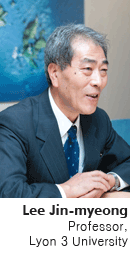
Disputes over the sovereignty of Dokdo have entered upon a new phase, as a statute document was revealed which contained evidence that Japan's Ministry of Finance acknowledged in 1946, "Dokdo is not Japanese territory." Korea has already gained an advantage in the conflicts over the Dokdo sovereignty with the help of the research of numerous scholars who have made ceaseless efforts to prove that Dokdo is Korean territory. Today, we have an interview with Professor Lee Jin-myeong who wrote "Dokdo, geographical rediscovery" and made achievements in research on the Dokdo sovereignty and naming East Sea.
Q. What makes you pay attention to the Dokdo issue?
In the late 1970s, after finishing my doctorate thesis in Paris, I started paying attention to the Dokdo issue when I came across the "Dokdo document" published by the Ministry of Foreign Affairs. When Dokdo emerged as a hot issue in the 1990s, causing tension between Korea and Japan, I reconsidered the issue in a serious way. And I decided to search for records in the West in addition to the existing documents. That's why in the autum of 1996 I tried to look for documents first in the "French Navy Museum" and then in the Archives Nationales and Bibliotheque National de France.
Q. Paldo-Chongdo (geographical map of the entire eight provinces) and complete maps of Joseon that were discovered and made public in 2005 are the most important historical records proving that Dokdo belongs to Korea. How did you feel at that time?
Like any scholar, when I discovered this good record, I was pleased enough to break into tears. Paldo-Chongdo which is assumed to be made after 1644 was owned by Collin de Plancy, the first French minister to Korea. This map, housed at the Bibliotheque National de France now, is considered to be the oldest map which correctly marked the location of Ulreungdo and Dokdo (Usando). Furthermore, in the "map of great Japan" which was produced by Japan during the Japanese occupation over Korea, Dokdo is clearly included in Joseon territory under the name of "Dakeshima." It can be said that this map proves that Japan did not include Dokdo in its territory.
Q. How far is your research on East Sea progressing?
I have searched for Western records on East Sea in various aspects: from the origin of "Sea of Korea" to who made the name used in the eighteenth century. When tracing back to its origin, I found out that map makers referred to and reflected the marks in other maps included in travel books in their own maps. I am looking for records and conducting research on where the origin is, how it was marked and the proportion of "Sea of Japan" to "Sea of Korea" in the ancient maps of the eighteenth century. While at sifting through documents and doing research, the same map can be interpreted differently depending on what perspective one has.
Q. in old maps containing descriptions of East Sea, "Sea of Korea" appeared before the ninetennth century, and then "Sea of Japan" was marked afterwards?
The work to search for maps related with naming East Sea dates back to the 17th century. The reason the Western records are so important in this area is that in fact East Asia did not give a name to a sea in the ancient times. The Western people started naming a sea in Asia. 80 percent of the 18th century maps marked East Sea as "Sea of Joseon." Then into the 19th century, the same sea changed into "Sea of Japan." The La Perouse expedition's nautical chart, which was the basic reference for a voyage, played a decisive role in this change. Since the expedition recorded East Sea as "Sea of Japan" when it found Ulreungdo, East Sea has been marked as "Sea of Japan" in maps worldwide.
The people around the world have used the name for over 200 years, so it is hard to change the name into East Sea. But thanks to bringing up the East Sea naming issue and making efforts to change people's understandings, there are more cases in which "Sea of Japan" and East Sea are marked side by side. It's very encouraging.
Q. Japan is increasingly provoking Korea by claiming sovereignty over Dokdo in its guidelines for textbooks. What would you say to Japan?
Japan's political leaders are doing something wrong. I believe it will not benefit their people. The Dokdo issue is different from the dispute over Japan's northern territory. It seems like the descriptions in textbooks teach Japan's youths to regain Dokdo later. But obviously it is the wrong education that encourages them to take over other country's territory that they will not be able to get. Therefore, Korea needs to keep calmness. Regardless of the current name of Dokdo, Korea has effective control over Dokdo, so it has to keep a calm attitude.
Q. What advice would you give regarding the activities of the Dokdo Research Institute which opened last year?
In addition, what do you think needs to be complemented in Korea's research on Dokdo or East Sea?
I know that there are already many good documents concerning Dokdo. Discovering and publishing new materials are important, but what's far more important is to translate the existing documents and disseminating them to more foreigners. Besides, to keep pace with the times, it is essential for Korea to digitalize its old documents, maps and other records related with Dokdo and East Sea. It would be wonderful for the government to build an e-library where anyone can search a database translated in many other languages on the Internet anywhere in the world.
Lee Jin-myeong, professor of Korean studies, Lyon 3 University in France
Books: "Dokdo in Western documents," "Dokdo, geographical rediscovery," etc.